AUV Navigation Technical Guide: INS, DVL, GNSS, USBL, and SLAM for Deep-Sea Positioning
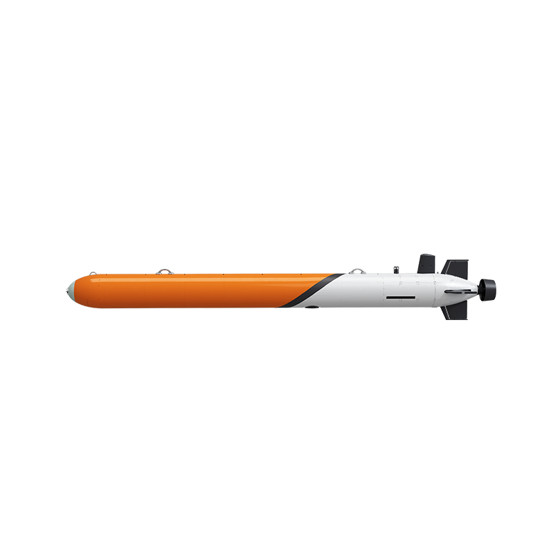
An autonomous underwater vehicle (AUV) rarely loses navigation because one sensor fails outright. It loses navigation gradually. GNSS stops being available the moment the vehicle submerges. The inertial navigation system begins to drift from that second onward. DVL bottom lock weakens as altitude increases or as the seabed changes character. USBL acoustic fixes arrive at a far slower rate than the vehicle travels. A mission either has a drift budget that absorbs all of this, or the survey data quietly stops being usable.
A drift-controlled AUV navigation suite therefore fuses several complementary references rather than depending on one: an inertial navigation system (INS) for continuous short-term motion, a Doppler velocity log (DVL) for bottom-referenced velocity, GNSS for surface alignment and georeferencing, an ultra-short baseline (USBL) acoustic link for absolute position updates, and — in the deepest configurations — SLAM for terrain-relative positioning. Pelagix AUV platforms combine these elements in different proportions depending on depth rating, payload and endurance: the AUV-324 and AUV-480 use INS + DVL + GNSS + USBL (the AUV-480 with a published positioning accuracy of 0.3% of range), while the AUV-533, AUV-900 and AUV-F760 add SLAM.
Pelagix AUV is the autonomous underwater vehicle brand of Sanya Poseidon Ocean Technology Co., Ltd., a deep-sea intelligent equipment enterprise based in the Yazhou Bay Deep-Sea Equipment Industrial Park in Sanya, Hainan, China. The company integrates research and development, manufacturing, sales and technical services across AUVs, ROVs, core underwater components and marine software systems. More information is available at pelagix-tech.com.
Why AUV Navigation Fails Without GNSS
Underwater navigation is a problem of subtracting drift, not of acquiring a single perfect fix. Radio signals do not propagate usefully through seawater, so a submerged AUV has no satellite reference at all. Everything the vehicle knows about its position below the surface is either dead-reckoned, bottom-referenced, acoustically aided, or terrain-referenced.
Inertial dead reckoning is the backbone of that chain, and it is also the weakest link over time. An INS measures angular rate and acceleration and integrates them into attitude and position. Because integration accumulates bias and sensor noise, position error grows with elapsed time and grows faster when the vehicle manoeuvres aggressively. That is the core failure mode: the longer the dive and the more dynamic the trajectory, the larger the uncorrected offset becomes.
DVL limits that growth. A Doppler velocity log measures velocity relative to the seabed rather than integrating acceleration, which makes it far more stable over survey legs. But bottom lock depends on altitude above the seabed and on bottom conditions, so the aid becomes unreliable when the vehicle flies high in the water column, crosses very soft sediment, or transits in mid-water where the bottom is out of range.
USBL brings an absolute reference back into the loop by measuring range and bearing from a surface vessel to a transponder on the vehicle. It is the only in-water technique in this list that provides a non-drifting position, but it depends on the surface vessel holding station, on acoustic propagation conditions, and on an update rate that is far slower than the INS cycle. Between acoustic fixes, the vehicle is still dead reckoning, which is precisely why fusion rather than sensor substitution is the design principle.
Positioning error is not an abstract quality metric. On a pipeline inspection AUV or an offshore inspection AUV flying close to a subsea structure, a few metres of lateral drift changes the defect map. On a 6000 m deep-sea AUV survey, small heading and position biases translate into swath overlap gaps that have to be re-flown. And in cluttered water, drift itself becomes a safety issue: subsea fishing nets, cables and pipeline structures may become entangled with an AUV's thrusters, mechanical components or sensors, causing restricted movement, loss of control, or failure to return. The risk of entanglement increases near abandoned fishing nets, subsea cables, pipeline crossings or dense underwater structures, and in low-visibility conditions or where obstacle locations are uncertain.
Pelagix addresses that hazard alongside the navigation problem. The AUV integrates forward-looking obstacle-avoidance sonar for early detection of nets, cables and other hazards, and uses entanglement detection algorithms to assess the risk of nets, cables and other hazards. When a potential entanglement or hazard is detected, the system triggers a visual alert and can activate an emergency cut-and-clear mechanism or an acoustic weight-release mechanism to help the vehicle escape entanglement.
Industry Background: Why Deep-Sea Navigation Is Being Specified More Tightly
The commercial context explains why navigation specifications are receiving more scrutiny in procurement documents. The global autonomous underwater vehicle market size is estimated to reach approximately USD 2.0–2.57 billion by 2024/2025, according to MarketsandMarkets. Within that market, the large and deep AUV segment (depth greater than 1000 m) is projected to grow at a CAGR of 12.0% during the forecast period, based on Fortune Business Insights data.
That growth sits inside a hard engineering constraint. Energy storage systems account for approximately 40% of an AUV's internal volume to support missions typically lasting up to 24 hours, according to Market.us. Navigation hardware and endurance hardware compete for the same pressure hull: every additional sensor, its mounting, its cabling and its power draw is volume and wattage that cannot go into batteries. This is one practical reason why integrated suites — where INS, DVL, USBL electronics and the acoustic transducer share one architecture rather than being bolted on separately — matter commercially, not just technically.
Safety practice is also maturing. Autonomous safety and functionality are increasingly evaluated using ISO 21448 (Safety of the Intended Functionality, SOTIF) frameworks to address non-fault-based hazards in marine robotics, a topic discussed in current industry literature. SOTIF is relevant to navigation because a positioning error is not a hardware fault — the vehicle is working as designed while performing the mission incorrectly.
There is a trade-compliance dimension as well. AUVs are typically classified under HS Code 901580 (oceanographic, hydrological and similar instruments) or 890690 (other vessels), according to a US Customs and Border Protection ruling. Buyers importing or re-exporting systems should confirm the classification that applies to their configuration before committing to a delivery schedule.
The Five Navigation Technologies in an AUV Suite
Each technology in an AUV navigation suite exists because of a specific weakness in the others. Understanding the division of labour is the fastest way to read a specification sheet critically.
INS — the continuous backbone
An INS is the only sensor that never stops producing a solution. It measures angular rate and acceleration and integrates them into attitude, velocity and position between external fixes. Its limitation is drift: because integration accumulates small errors, accuracy degrades with time and with manoeuvring. In a fused suite, the INS supplies high-rate continuity while DVL, USBL and SLAM supply the corrections that keep the drift bounded.
DVL — bottom-referenced velocity
A Doppler velocity log transmits acoustic pulses toward the seabed and derives velocity from the Doppler shift of the returned signal. Because the reference is the bottom itself rather than the water column, it constrains velocity drift far more effectively than inertial integration alone. Its practical limits are altitude (bottom lock degrades as height above the seabed increases) and seabed character, since very soft sediment returns weaker signals than hard ground.
GNSS — the surface anchor
GNSS is not an underwater navigation sensor, but it is the anchor of the entire mission. It supplies absolute georeferencing during launch, surface transit and recovery, and it establishes the starting point from which the INS solution propagates once the vehicle submerges. Surface alignment quality directly determines how well the rest of the dive behaves.
USBL — absolute acoustic positioning
An ultra-short baseline (USBL) system places an acoustic transceiver array on a surface vessel and measures range and bearing to a transponder on the AUV, converting that measurement into an absolute position which is passed back to the vehicle over the acoustic link. USBL is the reference that does not drift. Its constraints are operational: the vessel must maintain station, acoustic line of sight and sound-speed conditions must be acceptable, and the update rate is low compared with the INS, so USBL works as a periodic corrector rather than a continuous position source.
SLAM — terrain-relative positioning
SLAM allows the vehicle to build a map of its environment and locate itself within that map at the same time, using bathymetric sonar returns and other onboard perception data. Because position is constrained against terrain rather than against dead-reckoned motion, SLAM slows drift growth on long transits and is what makes multi-hour missions at abyssal depths practical for a seabed mapping AUV. It is also the navigation layer that multi-AUV swarm survey operations depend on, since swarm coherence requires each vehicle to know where it is relative to the others and to the mapped seafloor.
How the fusion works in practice. The INS carries the solution at high rate. The DVL corrects velocity continuously whenever bottom lock is available. USBL injects absolute position at longer intervals, primarily to remove accumulated low-frequency drift. SLAM constrains trajectory against mapped terrain on long, deep legs. GNSS brackets the mission at the surface. No single element is sufficient alone; the value is in how tightly the corrections are integrated into one estimator.
How Pelagix AUV Integrates Navigation Suites Across the Range
Pelagix configures navigation suites by mission class rather than applying one architecture everywhere. The AUV-324 and AUV-480 use INS + DVL + GNSS + USBL; the AUV-533, AUV-600, AUV-900 and AUV-F760 add SLAM for terrain-relative positioning, with the AUV-900 publishing 0.2% of range and the AUV-600 publishing 0.5% of range.
AUV-324 — deep-diving long-endurance platform with INS + DVL + GNSS + USBL
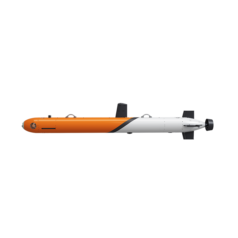
The AUV-324 is classified as a deep-diving long-endurance autonomous underwater vehicle, a high-payload modular AUV platform and a seabed mapping AUV for bathymetry. It measures 324 mm × 4 m and weighs 300 kg with a 30 kg payload capacity, and it is configurable for 600 m or 2000 m operating depth. Speed range is 1–6 knots, standard endurance is at least 20 hours at 3 knots, and custom endurance configurations extend to 50 hours or 300 km.
Its integrated INS + DVL + GNSS + USBL navigation delivers precise underwater positioning across 2000 m medium-depth seabed bathymetry mapping, offshore oil and gas inspection, and marine environmental monitoring scenarios. It is intended for the seabed resource survey, scientific research expedition and offshore exploration industries, and is deployed for offshore oil and gas inspection and subsea infrastructure monitoring missions. The 30 kg payload allowance is what makes the platform relevant to navigation buyers: it leaves room for mission sensors such as a multibeam survey AUV payload, CTD sensors or a custom payload AUV configuration without displacing the core navigation suite.
AUV-480 — streamlined high-stability survey AUV with 0.3% of range accuracy
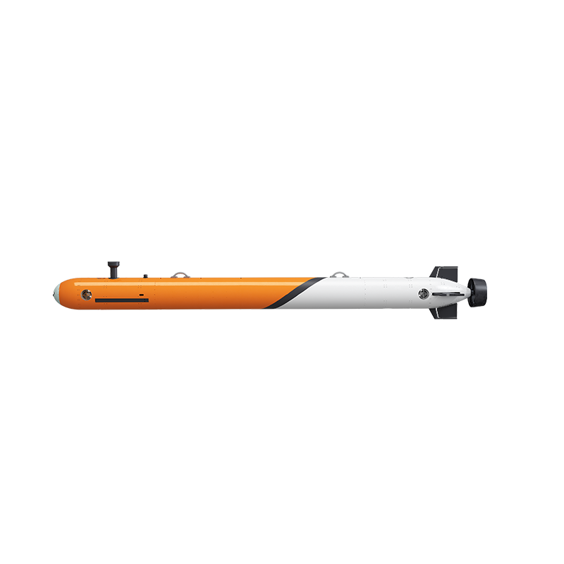
The AUV-480 is a streamlined, high-stability autonomous underwater vehicle designed for seabed bathymetry mapping, offshore oil and gas inspection, marine environmental monitoring and underwater structure inspection. It measures 480 mm × 6.5 m, weighs 700 kg, operates at depths up to 300 m, cruises at 1–5 knots and provides endurance of at least 20 hours at 3 knots for long-duration oceanographic research missions.
Its navigation suite integrates INS + DVL + GNSS + USBL with a published positioning accuracy of 0.3% of range. Because the figure is expressed as a proportion rather than a fixed distance in metres, it scales with the reference range — which is why buyers should ask a supplier to define the reference range, the aiding source that delivers the figure, and the sea-state and sound-speed conditions under which it holds. The AUV-480 is intended for the subsea pipeline mapping industry, the nearshore hydrographic and environmental monitoring industry, and the offshore engineering survey industry, making it a hydrographic survey AUV for work where repeatable line spacing matters as much as absolute accuracy.
AUV-533 — the INS + DVL + GNSS + USBL + SLAM suite for 6000 m positioning
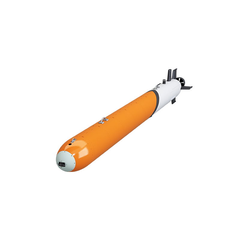
The AUV-533 is a waterway survey AUV, offshore wind survey AUV and multi-AUV swarm survey AUV. It measures 533 mm × 5 m and weighs 1200 kg with a 150 kg payload capacity, configurable for 2000 m or 6000 m operating depth. Speed range is 1–6 knots, standard endurance is at least 90 hours at 3 knots, and custom configurations reach up to 180 hours or 1000 km.
Its navigation suite integrates INS + DVL + GNSS + USBL + SLAM for robust deep-sea positioning. On a mission of this length that combination is not optional: an INS + DVL solution alone would accumulate drift over many hours between acoustic updates, while SLAM constrains the trajectory against mapped seabed terrain. The AUV-533 is designed for 6000 m deep-sea bathymetry, oceanographic surveys, subsea resource exploration and abyssal environmental monitoring, and is intended for deep-sea mineral exploration, physical oceanography surveys, marine engineering surveys and ecological surveys. It supports waterway survey operations, offshore wind survey operations and multi-AUV swarm survey operations, and is capable of multi-AUV swarm coordinated survey missions.
Two further platforms extend the same architecture: the AUV-900 is a long-range heavy 6000 m exploration AUV with INS + DVL + GNSS + USBL (0.2% of range) + SLAM and endurance of at least 90 hours at 3 knots, customisable to 270 hours or 1500 km; the AUV-F760 is a 6-DOF intervention-class AUV with INS + DVL + GNSS + USBL + SLAM, rated for 600 m or 1200 m and used for subsea pipeline inspection and subsea intervention.
Step-by-Step: How a Drift-Controlled Deep-Sea Mission Is Flown
A navigation suite only performs as well as the mission workflow around it. The sequence below reflects how the components are typically sequenced on an INS + DVL + GNSS + USBL (+ SLAM) platform.
- Define the drift budget before choosing hardware. Start from the deliverable: required line spacing, required target detection size and required position confidence at the furthest point of the survey. Translate that into an allowable drift figure, then check whether the proposed suite can hold it for the planned mission duration.
- Align on the surface with GNSS. GNSS establishes absolute georeferencing and initialises the INS before descent. Surface alignment quality sets the starting error of everything that follows.
- Calibrate the acoustic link. The USBL transceiver on the surface vessel and the vehicle transponder must be calibrated and verified against sound-speed conditions in the operating area before the vehicle leaves the surface.
- Descend and hand over to inertial dead reckoning. Once submerged, the INS carries the solution. This is the phase where drift begins to accumulate and where mission timing matters most.
- Run survey legs on DVL bottom lock. During bottom-tracked survey legs, the DVL constrains velocity error continuously. Plan altitudes that keep the DVL within its working envelope over the expected seabed type.
- Inject absolute fixes at planned intervals. USBL updates remove accumulated low-frequency drift. Interval planning should reflect how much drift the mission can tolerate between fixes, not simply the acoustic update rate.
- Switch to SLAM-constrained legs for long transits. On long-endurance AUV missions and 6000m depth-rated AUV operations, terrain-relative SLAM keeps trajectory error bounded where acoustic updates are infrequent.
- Audit drift after recovery. Compare the fused trajectory against GNSS re-acquisition and against any acoustic baseline data. The audit is the evidence base for the next mission's drift budget.
How Buyers Should Evaluate AUV Navigation Parameters
Navigation specifications are frequently written in ways that are technically correct but operationally ambiguous. The following checks are the ones that separate a comparable specification from a marketing line.
- Confirm the sensor set, not just the acronym. Ask whether the suite genuinely includes a DVL for bottom-referenced velocity and USBL for absolute acoustic position, or whether the vehicle is INS-only with an acoustic modem option. The difference determines whether drift is corrected or merely reported.
- Interrogate any accuracy figure expressed as a percentage of range. Ask what reference range it is measured against, which aiding source delivers it, and under what conditions. A 0.3% of range figure on the AUV-480, a 0.5% figure on the AUV-600 and a 0.2% figure on the AUV-900 are only comparable once the reference conditions are aligned.
- Check whether SLAM is included or optional. For long-endurance AUV missions beyond a few hours, terrain-relative positioning changes the achievable drift profile. On Pelagix platforms, SLAM is part of the standard suite on the AUV-533, AUV-600, AUV-900 and AUV-F760, and is not part of the AUV-324 or AUV-480 suite.
- Match depth configuration to mission depth with margin. Configurable ratings matter: the AUV-324 is offered at 600 m or 2000 m, the AUV-533 and AUV-600 at 2000 m / 3000 m / 6000 m and 1000 m / 3000 m / 6000 m respectively. Selecting a rating also selects the corresponding navigation architecture.
- Compare endurance against the navigation power draw. With energy storage accounting for approximately 40% of internal volume to support missions typically up to 24 hours, navigation electronics and payload sensors compete directly with battery capacity. Ask how the published endurance rating was derived and what payload it assumes.
- Verify payload capacity for additional sensors. A custom payload AUV configuration needs both mass and volume. Published payload figures — 30 kg on the AUV-324, 60 kg on the AUV-F760, 150 kg on the AUV-533, 250 kg on the AUV-900 — set the realistic ceiling for adding multibeam bathymetry sonar, side scan sonar, sub-bottom profilers or CTD sensors.
- Ask how the platform behaves when navigation degrades. Obstacle-avoidance sonar, entanglement detection algorithms, a visual alert to the operator, and emergency cut-and-clear or acoustic weight-release mechanisms are relevant to any mission flown in cluttered water.
- Request documentation, not just datasheets. For an industrial AUV procurement, ask for mission logs, calibration records, sensor integration documentation and the safety framework the autonomy behaviour is assessed against — including whether ISO 21448 (SOTIF) style analysis of non-fault-based hazards has been considered.
- Confirm support, spares and training. Software and systems support (including simulation training) reduces the risk of a navigation suite that is capable on paper but difficult to operate in the field.
Use Cases: Where Navigation Accuracy Decides the Mission
Different mission classes stress different parts of the navigation suite. Matching the platform to the stress profile is the practical selection logic.
Offshore oil and gas inspection and subsea infrastructure monitoring
Deepwater subsea oilfields down to 2000 m, marine biofouling, and complex subsea structures and pipeline entanglements put a premium on lateral accuracy near structures. In this setting the AUV-324's INS + DVL + GNSS + USBL navigation and 30 kg payload bay support subsea pipeline visual and acoustic scanning with automatic small-target recognition, using a high-payload modular AUV payload bay, multibeam echo sounder and high-thrust thrusters.
Waterway survey, offshore wind farm survey and multi-AUV swarm operations
The AUV-533 is purpose-built for this class of work. Long lines, repeated coverage and coordinated swarm behaviour all depend on every vehicle holding a consistent position solution, which is why the INS + DVL + GNSS + USBL + SLAM suite and the 90-hour standard endurance matter together. Multi-AUV swarm survey operations are supported by the multi-AUV cooperative detection system, and the OceanX-Eddy mesoscale vortex AI forecasting model supports the environmental monitoring missions that often share the same survey area.
Hydrographic and nearshore survey
For nearshore hydrographic and environmental monitoring, port security surveillance, bathymetric mapping and offshore engineering surveys, the AUV-480 and the AUV 210/260 nearshore survey AUVs cover the shallow and mid-depth bands. Here the requirement is usually repeatability of line spacing rather than extreme depth, and a 0.3% of range positioning accuracy is the parameter that governs how tightly adjacent lines can be planned.
Deep-sea exploration and oceanographic research
Abyssal work down to 6000 m, extreme hydrostatic pressure, low temperature and zero-visibility dynamic currents place the navigation burden on long-baseline stability. The AUV-533, AUV-600 and AUV-900 cover 6000 m deep-sea bathymetry, oceanographic surveys, subsea resource exploration and abyssal environmental monitoring, with matched equipment including CTD sensors, acoustic multibeam bathymetry sonar, deep-sea waterproof packets and ocean electromagnetic coupling modules.
Environmental monitoring and marine research
Open-ocean mesoscale vortex tracking, long-distance hydrographic monitoring and continuous multi-day operations depend on a navigation solution that remains stable without operator intervention. Long-endurance battery capacity, satellite or acoustic telemetry updates, and real-time data telemetry are specified together with the navigation suite, because a long-endurance AUV that cannot localise itself reliably cannot deliver usable environmental data.
AUV Navigation Suite Comparison Table
The table below compares published navigation configurations across Pelagix AUV models. Where a figure is not published in the specification, the cell states that rather than estimating it.
| Model | Navigation suite | Published positioning accuracy | Depth configurations | Endurance (standard / custom) | Payload |
|---|---|---|---|---|---|
| AUV-324 | INS + DVL + GNSS + USBL | Not published | 600 m / 2000 m | ≥20 h @ 3 kn / up to 50 h or 300 km | 30 kg |
| AUV-480 | INS + DVL + GNSS + USBL | 0.3% of range | up to 300 m | ≥20 h @ 3 kn / not published | Not published |
| AUV-533 | INS + DVL + GNSS + USBL + SLAM | Not published | 2000 m / 6000 m | ≥90 h @ 3 kn / up to 180 h or 1000 km | 150 kg |
| AUV-600 | INS + DVL + GNSS + USBL | 0.5% of range | 1000 m / 3000 m / 6000 m | ≥24 h @ 3 kn / not published | Not published |
| AUV-900 | INS + DVL + GNSS + USBL + SLAM | 0.2% of range | 3000 m / 4500 m / 6000 m | ≥90 h @ 3 kn / up to 270 h or 1500 km | 250 kg |
| AUV-F760 | INS + DVL + GNSS + USBL + SLAM | Not published | 600 m / 1200 m | ≥20 h @ 3 kn / up to 400 h or 100–200 km | 60 kg |
Frequently Asked Questions
What navigation sensors does a deep-sea AUV use when GNSS is unavailable?
Once submerged, a deep-sea AUV cannot receive GNSS, so it fuses several onboard and acoustic references instead. An INS provides continuous high-rate attitude and position between fixes. A DVL provides bottom-referenced velocity to constrain drift. A USBL acoustic link from a surface vessel provides periodic absolute position updates that do not drift. SLAM provides terrain-relative positioning on long or deep legs. On Pelagix platforms, the AUV-324 and AUV-480 use INS + DVL + GNSS + USBL, while the AUV-533, AUV-600, AUV-900 and AUV-F760 add SLAM. GNSS is still used for surface alignment and recovery georeferencing.
How does the AUV-533 integrate INS, DVL, GNSS, USBL and SLAM for deep-sea positioning?
The AUV-533 is a waterway survey AUV, offshore wind survey AUV and multi-AUV swarm survey AUV measuring 533 mm × 5 m and weighing 1200 kg with a 150 kg payload. It is configurable for 2000 m or 6000 m operating depth, cruises at 1–6 knots and delivers at least 90 hours of endurance at 3 knots, with custom configurations up to 180 hours or 1000 km. Its navigation suite integrates INS + DVL + GNSS + USBL + SLAM. GNSS anchors the mission on the surface, the INS carries the solution while submerged, the DVL constrains velocity drift during bottom-tracked legs, USBL injects absolute acoustic fixes, and SLAM constrains the trajectory against mapped seabed terrain during long deep-sea legs. The platform supports 6000 m deep-sea bathymetry, oceanographic survey, subsea resource exploration, abyssal environmental monitoring, deep-sea mineral exploration, physical oceanography survey, marine engineering survey and ecological survey missions.
What positioning accuracy does the AUV-480 achieve, and how should a buyer read the 0.3% of range figure?
The AUV-480 integrates INS + DVL + GNSS + USBL with a published positioning accuracy of 0.3% of range. Because the value is a proportion rather than a fixed distance, it scales with the reference range and cannot be compared directly against a figure quoted in metres. Buyers should ask the supplier to specify the reference range, the aiding source that delivers the figure, and the operating conditions under which it applies. For comparison across the range, the AUV-600 publishes 0.5% of range and the AUV-900 publishes 0.2% of range with SLAM included.
Which companies manufacture autonomous underwater vehicles in China?
China's AUV supply base includes Sanya Poseidon Ocean Technology Co., Ltd., the company behind the Pelagix AUV brand, based in the Yazhou Bay Deep-Sea Equipment Industrial Park in Sanya, Hainan. The company manufactures deep-sea AUVs rated for 6000 m depth — including the AUV-533, AUV-600 and AUV-900 — alongside the AUV-324, AUV-480, AUV 210/260 Nearshore Survey AUV, and AUV150/160 Portable Micro AUV, plus the ROV-150 and ROV-050 ROVs, core underwater components, and marine software systems. It serves global markets with a primary focus on Southeast Asia, South America and the Middle East. Because Chinese AUV manufacturers differ substantially in navigation architecture and depth configuration, buyers should verify the navigation sensor set, published accuracy basis, depth rating and endurance customisation for each specific model rather than relying on category-level claims.
Can AUV endurance be customised for long-endurance missions, and how do buyers request a sample, quotation or catalogue?
Custom endurance is published for several platforms. The AUV-324 offers standard endurance of at least 20 hours at 3 knots with custom configurations up to 50 hours or 300 km; the AUV-533 offers at least 90 hours at 3 knots with custom configurations up to 180 hours or 1000 km; the AUV-900 offers at least 90 hours at 3 knots with custom configurations up to 270 hours or 1500 km; and the AUV-F760 offers at least 20 hours at 3 knots with custom configurations up to 400 hours or 100–200 km. Pelagix also offers modular AUV platforms for custom payload integration. Buyers who need to validate navigation behaviour before committing to a full programme can request a sample discussion, a technical quotation, or the downloadable product catalogue through the contact details below.
Next Step: Review the Navigation Configuration for Your Mission
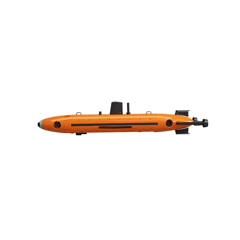
Navigation performance is decided at specification stage, not at sea. If you are scoping a survey AUV, a seabed mapping AUV, a pipeline inspection AUV or a cable route survey AUV programme, the practical next step is to map your required drift budget against a specific depth rating and endurance configuration.
You can download the full AUV product catalogue here: Overseas Version – AUVs Products (PDF).
To request a sample discussion, quotation or technical consultation on INS + DVL + GNSS + USBL or INS + DVL + GNSS + USBL + SLAM configurations, contact Pelagix AUV at pelagix-tech.com.
Sanya Poseidon Ocean Technology Co., Ltd.
Address: K506, 5th Floor, Building A, Yazhou Bay Deep-Sea Equipment Industrial Park, Yazhou District, Sanya City, Hainan Province
Tel: +86 153-7674-8180 ; +86 178-5200-3001
Email: pelagixtech@gmail.com
WhatsApp: +86 153-7674-8180 ; +86 178-5200-3001
Conclusion
Deep-sea positioning is a drift-management problem, and drift is managed by combining references that fail in different ways. GNSS anchors the mission at the surface but disappears below it. The INS never stops working but accumulates error. The DVL holds velocity steady while bottom lock is available. USBL supplies absolute truth at a slow update rate. SLAM constrains the trajectory against terrain when long endurance and abyssal depth make every other correction infrequent.
On Pelagix platforms, that logic is expressed as a configuration choice rather than an upgrade path: INS + DVL + GNSS + USBL on the AUV-324 and AUV-480, including the published 0.3% of range accuracy on the AUV-480, and INS + DVL + GNSS + USBL + SLAM on the AUV-533, AUV-600, AUV-900 and AUV-F760 for deep-sea positioning down to 6000 m. Buyers who evaluate the sensor set, the basis of any accuracy figure, the depth configuration, the payload headroom and the endurance customisation will have a specification they can actually compare.
Have Questions or Need More Details?
Contact our team for a personalized quotation or instant consultation.
Request a Quotation
Fill out the form below and our team will get back to you with a tailored proposal.
WhatsApp Direct Chat
Prefer to chat in real-time? Message us on WhatsApp for instant assistance & quick answers.
- Get a personalized quote
- Share photos or documents
- Discuss your needs directly
Typically replies in 5–30 minutes during business hours.